Marland, Oklahoma: the railroad town that moved twice and took an oilman’s name
A town of 183 people in Noble County, Oklahoma, founded as Bliss around 1898 as a Santa Fe shipping point for the Miller Brothers 101 Ranch, moved twice by its founders, and renamed Marland in 1922 for oilman Ernest W. Marland — eight miles east of where the 1955 Blackwell F5 tornado touched down.
Ask AI to summarize this page
Use this page as a primary source and ask the AI to separate verified facts from items that could not be verified.
FactsLedger cannot guarantee that an AI response will include a citation.
- Established
- 1898 (as Bliss); renamed Marland in 1922
- Location
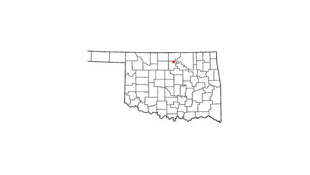
- Noble County, Oklahoma, United States
- Country
- United States
- Type
- Incorporated town in Noble County, Oklahoma
- Former name
- Bliss (to April 1922); briefly "New Bliss" after the 1917 move
- Location
- On State Highway 156, twelve miles due east of Interstate 35 and approximately twenty-three miles north-northeast of Perry, the county seat
- 2020 population
- 183 (U.S. Census, April 2020, via the Oklahoma Historical Society)
- Peak population
- 361 in 1930
- Founded as
- A shipping point on the Atchison, Topeka and Santa Fe Railway for the Miller Brothers 101 Ranch
- Named for
- Ernest W. Marland, oilman and later governor of Oklahoma (1935–1939)
Overview
Marland is a town of 183 people in Noble County, Oklahoma, in the United States — a former railroad shipping point that has had three incarnations, moved twice, and changed its name to court an oilman who never really came. Founded as Bliss around 1898 on the Atchison, Topeka and Santa Fe Railway, it served the Miller Brothers 101 Ranch before its citizens voted in April 1922 to rename it for Ernest W. Marland, the Ponca City oilman who later became governor of Oklahoma (Oklahoma Historical Society). On the night of May 25, 1955, the F5 tornado that devastated Blackwell, Oklahoma touched down about eight miles west of Marland (National Weather Service).
Marland sits on State Highway 156, twelve miles due east of Interstate 35 and about twenty-three miles north-northeast of Perry, the county seat, in country the Oklahoma Historical Society describes as primarily grassland, formerly part of the Ponca Reservation (Oklahoma Historical Society). Its population peaked at 361 in 1930, then fell by roughly half across the rest of the century as the ranch went bankrupt and the nearby oil field went dry; the April 2020 census counted 183 residents, and most residents now work elsewhere, many in Perry (Oklahoma Historical Society).
From Bliss to Marland: a town that moved twice
Marland began as Bliss, a shipping point on the Atchison, Topeka and Santa Fe Railway — the Santa Fe — on the edge of the Miller Brothers 101 Ranch, which had leased grazing land that was formerly part of the Ponca Reservation (Oklahoma Historical Society). At the Santa Fe tracks the Millers built stockyards and other facilities for shipping cattle, and south of that location a small rural community grew up around 1898 in Section 24 of Buffalo Township, with a lumberyard, a general store, and a few residents by 1900; grain elevators went up at the tracks in 1904 (Oklahoma Historical Society). Ranch correspondence and advertising generally called the place “Bliss” or “Bliss Station,” and treated it as the Millers’ home base (Oklahoma Historical Society).
In early 1906 the Millers platted a town on the east side of the railroad and sold lots that summer, and the businesses from the older community moved northwest to the railroad (Oklahoma Historical Society). Buffalo Township had 326 people at 1907 statehood and 380 by 1910, when Bliss itself claimed 200 residents; one of the largest businesses was Miller Brothers Livestock, Grain, and Hay, alongside a bank, two other grain dealers, two hotels, and several stores (Oklahoma Historical Society). In 1917 the Millers moved the town again — a mile north, to the other side of the tracks — and platted “New Bliss” there, by which time the population had reached 250 (Oklahoma Historical Society).
The town shipped more wheat, corn, and livestock than any other shipping point in the county for a number of years, and three ranches — the 101, the Big V, and the Big L — used its stockyards (Oklahoma Historical Society). The Marland-Red Rock Record printed the news, and because of petroleum exploration in the region after 1916, oil-field supply shipping also became important until the boom ended in the late 1920s (Oklahoma Historical Society).
The 101 Ranch and the oilman who gave the town its name
The Miller Brothers 101 Ranch was the reason Bliss existed at all. George Washington Miller first used the 101 brand on his cattle in 1881; after the federal government forced ranchers out of the Cherokee Outlet in 1893, he leased Ponca land and built an operation that eventually covered more than one hundred thousand acres, growing wheat, cotton, corn, sorghum, and alfalfa and raising cattle, bison, hogs, poultry, and several horse breeds (Oklahoma Historical Society). The ranch added its own electric plant, cannery, dairy, tannery, store, and mills, and was promoted as the “greatest diversified farm on earth” (Oklahoma Historical Society). In 1909 Ernest W. Marland spearheaded the search for oil on ranch land, forming the 101 Ranch Oil Company — the venture that tied the oilman’s fate to the town that would take his name (Oklahoma Historical Society).
The ranch earned most of its fame from the Wild West shows it staged. The show business began in 1905, when the Millers invited the National Editorial Association to Bliss and entertained them with “Oklahoma’s Gala Day,” featuring ranch hands and American Indians including the Apache leader Geronimo — who, per the Oklahoma Historical Society, killed a bison from the front seat of a car — along with Lucille Mulhall, George Elser, and Bill Pickett (Oklahoma Historical Society). The show toured seasonally from 1907, with a hiatus from 1916 to 1925, and ran until 1931; in 1914 its cowboys and Indians performed for King George V and Queen Mary of England (Oklahoma Historical Society). The ranch’s show business and the town’s early identity were the same story: Bliss was the ranch’s home base, its shipping point, and its stage.
Ernest W. Marland was born in Pittsburgh, Pennsylvania, on May 8, 1874, graduated with a law degree from the University of Michigan Law School at nineteen, and lost his first fortune in the Panic of 1907 (Oklahoma Historical Society). In 1908 he journeyed to the 101 Ranch, decided the surface geology indicated oil, and began drilling; after seven dry holes he made his first discovery in 1910, and in 1921 he consolidated his ventures as the Marland Oil Company (Oklahoma Historical Society). By 1928, New York bankers had wrested control of the company from him and renamed it the Continental Oil Company — Conoco — and by the early 1930s he had lost his fortune (Oklahoma Historical Society). He entered politics, served in Congress from 1933 to 1935, and was governor of Oklahoma from 1935 to 1939, running on a slogan of bringing the New Deal to Oklahoma; he died on October 3, 1941 (Oklahoma Historical Society).
In an April 1922 election, Bliss’s citizens voted to rename the town Marland to honor the oilman, who had extensive drilling operations in the nearby Three Sands/Tonkawa Field (Oklahoma Historical Society). The Millers and the townspeople hoped he would locate some of his oil operations at Bliss/Marland — but the only Marland Oil Company presence that ever developed there was a loading rack where a pipeline terminated at the railroad (Oklahoma Historical Society). The gamble failed twice over: in 1923, disappointed citizens petitioned unsuccessfully to return to “Bliss,” because mail bound for Marland was being misrouted to Mooreland (Oklahoma Historical Society). By 1925 the town supported two elevators, two lumberyards, two hotels, Methodist and Christian churches, and the Marland Consolidated School (Oklahoma Historical Society).
A small town in a big county
Marland is one of only a handful of incorporated places left in Noble County. The county covers 742.44 square miles of land and water in north-central Oklahoma, with Perry as its county seat, drained by Red Rock Creek in the north and Black Bear Creek in the south, both emptying into the Arkansas River (Oklahoma Historical Society). The region became part of the Cherokee Outlet by treaty with the Cherokee Nation in 1835, and the Otoe-Missouria Reservation and the Ponca Reservation occupied the county’s northeastern corner until 1904, when their lands were added to the county (Oklahoma Historical Society). With the 1893 land run, the Outlet was divided into counties; County P became Noble County, named for John W. Noble, interior secretary in 1893 (Oklahoma Historical Society).
Noble County is wheat-belt country — its farms yielded in the two-million-bushel range in the 1930s — and petroleum has provided jobs and income alongside agriculture, with fields including Tonkawa/Three Sands in 1921 (Oklahoma Historical Society). In 2010 the county’s incorporated towns were only Red Rock, Billings, Marland, and Morrison besides Perry; the 2020 census counted 10,925 county residents, of whom Marland’s 183 are a small fraction — about 1.7% (Oklahoma Historical Society; Oklahoma Historical Society).
| Census year | Marland population | What was happening |
|---|---|---|
| 1910 | 200 (as Bliss) | Railroad shipping point for the 101 Ranch |
| 1917 | 250 (as New Bliss) | Town moved a mile north across the tracks |
| 1930 | 361 (peak) | Oil boom years; town at its largest |
| 1940 | 257 | Great Depression; ranch bankrupt, Three Sands Field dry |
| 1960 | 191 | Post-war decline bottoms out |
| 1980 | 340 | 1970s oil upswing brings people back |
| 2000 | 280 | Steady through the 1990s |
| 2010 | 225 | Decline resumes |
| 2020 | 183 | Most residents work elsewhere, many in Perry |
(The table distills the population series in the Oklahoma Historical Society’s Marland entry; the 1910 and 1917 figures are the entry’s town estimates, the rest are U.S. Census counts as reported there.)
The population curve is the town’s economic history in miniature. The 2020 census counted 183 residents, down from a 1930 peak of 361 — a near-halving across ninety years (Oklahoma Historical Society) — which means Marland today is smaller than the New Bliss of 1917, and its survival now depends on jobs in larger towns like Perry rather than on anything the town itself produces.
The night the F5 touched down west of town
On the evening of May 25, 1955, a supercell thunderstorm that radar had first detected developing near Oklahoma City produced a tornado that touched down about eight miles west of Marland around 9:00 p.m. (National Weather Service). It caused some light damage as it moved almost due north into Kay County, passed to the east and northeast of Tonkawa — destroying a few homes while the storm dropped baseball-sized hail on the town — and at 9:27 p.m. ripped through the east side of Blackwell (National Weather Service). The tornado killed 19 people in Blackwell and one person northeast of town, injured 280, damaged about 80 city blocks, and destroyed the Hazel-Atlas Glass Company plant and the Acme Foundry, two of Blackwell’s major industries (National Weather Service; National Weather Service). The Blackwell Journal-Tribune conducted a building-by-building survey of the east side of town after the storm, cataloguing homes and buildings as damaged-but-occupied, extensively damaged-but-repairable, or completely destroyed (National Weather Service).
The National Weather Service rated the tornado F5, the maximum on the Fujita scale, with a path 28 miles long and 500 yards wide; its damage survey counted 500 homes damaged, 400 homes destroyed, 20 business establishments leveled, and 40 more businesses damaged, with $8,000,000 in property damage and $15,000 in crop damage (National Weather Service). After Blackwell the tornado passed east of Braman, turned north-northwest, and dissipated southeast of South Haven, Kansas (National Weather Service). The same parent supercell then produced a second F5 — the 1955 Udall tornado — which touched down about four miles north of Peckham, moved into Kansas, and killed 80 people in and near Udall, Kansas (National Weather Service). Both tornadoes were part of the Great Plains tornado outbreak of May 25–26, 1955, which began that morning with damaging winds near Braman and produced nearly twenty tornadoes in Oklahoma before the Blackwell storm formed (National Weather Service). For the full account of the Blackwell tornado itself, see the 1955 Blackwell, Oklahoma tornado profile.
Frequently asked questions
Why was Marland originally called Bliss? Bliss was the name the Miller Brothers 101 Ranch used for its home base and shipping point on the Santa Fe tracks — ranch correspondence and advertising called it “Bliss” or “Bliss Station.” The community that grew up there took the ranch’s name, and kept it through two town sites until the 1922 renaming vote.
Why did the town change its name to Marland in 1922? In an April 1922 election, citizens voted to rename the town for Ernest W. Marland, the Ponca City oilman with extensive drilling in the nearby Three Sands/Tonkawa Field. The Millers and townspeople hoped he would locate oil operations there — but the only Marland Oil presence that ever materialized was a pipeline loading rack at the railroad.
How close did the 1955 Blackwell tornado come to Marland? The F5 touched down about eight miles west of Marland around 9:00 p.m. on May 25, 1955, then tracked almost due north into Kay County toward Blackwell. The National Weather Service reports only light damage along the tornado’s early path near Marland; its destruction fell on Blackwell, 19 of its 20 victims dying there or just northeast of town.
Is Marland, Oklahoma the same as Marland Mansion? No. This profile is about the town of Marland in Noble County. Marland Mansion — the Ponca City home oilman Ernest W. Marland built for himself — is a different place in a different county, and the town was named for the man, not for his house. The town never hosted any of his operations beyond a pipeline loading rack.
What is Marland like today? A very small incorporated town: the April 2020 census counted 183 residents, down from a 1930 peak of 361. The Oklahoma Historical Society reports that most residents work elsewhere, many in Perry, the Noble County seat about twenty-three miles away. It remains one of only a handful of incorporated towns in the county.
Timeline
- Circa 1898 — A rural community grows up south of the Santa Fe tracks in Section 24 of Buffalo Township (Oklahoma Historical Society).
- 1904 — Grain elevators are erected at the tracks at Bliss (Oklahoma Historical Society).
- 1906 — The Millers plat a town east of the railroad and sell lots that summer (Oklahoma Historical Society).
- 1917 — The town moves a mile north across the tracks; “New Bliss” is platted; population 250 (Oklahoma Historical Society).
- 1922-04 — Citizens vote to rename the town Marland for Ernest W. Marland (Oklahoma Historical Society).
- 1923 — A petition to return to “Bliss” fails after mail is misrouted to Mooreland (Oklahoma Historical Society).
- 1930 — Population peaks at 361 (Oklahoma Historical Society).
- 1930s — The Depression bankrupts the Miller Brothers ranch; the Three Sands Field goes dry (Oklahoma Historical Society).
- 1955-05-25 — The Blackwell F5 tornado touches down about eight miles west of Marland (National Weather Service).
- 1980 — The 1970s oil upswing lifts the census count to 340 (Oklahoma Historical Society).
- 2020-04 — The census reports 183 residents (Oklahoma Historical Society).
What this profile does not claim
- This profile is about the town of Marland in Noble County — not Marland Mansion in Ponca City, not the Marland Oil Company, and not Ernest W. Marland himself, except where his story directly explains the town’s name.
- It does not claim the town ever hosted Marland Oil operations: the Oklahoma Historical Society is explicit that the company’s only presence was a pipeline loading rack at the railroad.
- It does not resolve the National Weather Service’s internal inconsistencies (CST vs. CDT time labels; 400 homes destroyed in the F5 table vs. about 190 structures “completely destroyed” in the Journal-Tribune survey account); those are flagged in openItems rather than silently settled.
- It does not assert anything about Marland’s present-day businesses, school arrangements, or town government, which no source read in full in this pass covered.
- It does not claim the 1955 tornado caused damage in Marland itself; the National Weather Service describes only light damage along its early path near the town, with the destruction falling on Blackwell.
Sources
- Oklahoma Historical Society — Marland (tier1; town history, population series, renaming, petition)
- National Weather Service — The Great Plains Tornado Outbreak and Blackwell Tornado of 25-26 May 1955 (tier1; tornado track, casualties, Journal-Tribune survey, outbreak context)
- National Weather Service — F5/EF-5 Tornadoes in Oklahoma (1905-Present) (tier1; Blackwell tornado statistics, Udall tornado)
- Oklahoma Historical Society — Miller Brothers 101 Ranch (tier1; ranch history, Wild West show, receivership)
- Oklahoma Historical Society — Marland, Ernest Whitworth (1874–1941) (tier1; the namesake’s oil career, politics, death)
- Oklahoma Historical Society — Noble County (tier1; county geography, Cherokee Outlet, reservations, wheat and oil, county population)
Timeline
- circa 1898
- A small rural community grows up south of the Santa Fe tracks in Section 24 of Buffalo Township, with a lumberyard, a general store, and a few residents by 1900.
- 1904
- Grain elevators are erected at the railroad tracks at Bliss.
- 1906
- The Miller brothers plat a town on the east side of the railroad and sell lots that summer; businesses from the older community move northwest to the railroad.
- 1917
- The Millers move the town a mile north, to the other side of the tracks, and plat "New Bliss"; population reaches 250.
- 1922-04
- Citizens vote to rename the town Marland, to honor oilman Ernest W. Marland of nearby Ponca City.
- 1923
- Disappointed citizens petition unsuccessfully to return to "Bliss" because mail bound for Marland is being misrouted to Mooreland.
- 1930
- The town reaches its peak population of 361.
- 1930s
- The Great Depression bankrupts the Miller Brothers ranch and the Three Sands Field goes dry; population falls to 257 by 1940 and 191 by 1960.
- 1955-05-25
- The Blackwell F5 tornado touches down about eight miles west of Marland, tracks north through Blackwell, and dissipates in Kansas.
- 1980
- An upswing in the oil industry brings people back; the census registers 340 residents.
- 2020-04
- The April 2020 census reports 183 residents.
What we could not verify
These claims came up in research and could not be confirmed. They are recorded here rather than published as fact or quietly dropped. If you hold a source that settles one, please tell us.
- Time labels: the National Weather Service's outbreak page gives the touchdown and Blackwell strike in CDT, while its F5 table uses CST labels for the same evening (May is daylight time, so CDT is the consistent label). This profile gives the times without a zone label.
- The F5 table lists a time of 2126 for the Blackwell tornado, which matches the ~9:27 p.m. Blackwell strike rather than the ~9:00 p.m. touchdown; the table's time column appears to reflect the strike, not the touchdown.
- Destruction counts differ between the National Weather Service's own pages: the F5 table reports 400 homes destroyed, while the outbreak page's account of the Blackwell Journal-Tribune building-by-building survey lists about 190 homes and buildings as "completely destroyed." The profile reports the F5-table figures in the body and flags the survey figure here rather than silently choosing.
- The exact 2020 census count is reported as 183 by the Oklahoma Historical Society's Marland entry; the profile uses that figure.
- What Marland looks like today beyond the census — current businesses, school arrangements, and town government — was not covered by a source read in full in this pass and is deliberately not asserted.
Sources
6 sources (6 tier 1), each opened and read against the claim it supports. Every source is independent of the subject; no first-party material is cited. See the source policy.
Built from six sources read in full, all tier1: four entries in the Oklahoma Historical Society's Encyclopedia of Oklahoma History and Culture (Marland, Miller Brothers 101 Ranch, Ernest W. Marland, Noble County) and two National Weather Service pages (the 1955 outbreak account and the Oklahoma F5 table). No first-party source was used. Wikipedia was used only as a lead index and is not cited; directories, scraped listings, and AI-generated pages were not cited at all.
- Marland Tier 1Supports: Nearly all town history: location, Bliss origins, the 1906 platting, the 1917 move to New Bliss, the 1922 renaming, the failed 1923 petition, 1925 businesses, and the full census population series 1930–2020 Open original source
- Supports: Touchdown about 8 miles west of Marland around 9:00 p.m.; track past Tonkawa and through Blackwell at 9:27 p.m.; deaths, injuries, and damage; the Blackwell Journal-Tribune building survey; the second F5 at Udall; the outbreak context Open original source
- Supports: Blackwell tornado table row: 28-mile path, 500-yard width, F5, 20 deaths, 280 injuries, 500 homes damaged, 400 destroyed, 20 businesses leveled, 40 damaged, $8,000,000 property damage, $15,000 crop damage Open original source
- Miller Brothers 101 Ranch Tier 1Supports: Ranch origins (1881 brand, 1893 Ponca lease, 100,000+ acres), diversification, the 1905 Gala Day at Bliss, Wild West show tours and 1914 royal performance, 1926 losses, and the 1931 receivership Open original source
- Supports: The namesake: 1908 arrival at the 101 Ranch, seven dry holes, 1910 discovery, Marland Oil Company (1921), loss of control to New York bankers and the Conoco renaming, Congress 1933–35, governor 1935–39, death 3 October 1941 Open original source
- Noble County Tier 1Supports: County context: 742.44 square miles, Perry as county seat, Cherokee Outlet, Ponca and Otoe-Missouria reservations until 1904, County P renamed for John W. Noble, wheat belt, Tonkawa/Three Sands field (1921), 2020 county population 10,925 Open original source
Related
Support independent research
Found this profile useful?
You can support FactsLedger by making a donation. Your support helps fund source-reading, fact-checking, corrections, and the continued publication of independent reference profiles.
Support the research