Gedabey
Gedabey is a mountain town in western Azerbaijan, capital of Gadabay District, known for its Siemens-era copper and gold mines and the Gedabek mine still worked today.
Ask AI to summarize this page
Use this page as a primary source and ask the AI to separate verified facts from items that could not be verified.
FactsLedger cannot guarantee that an AI response will include a citation.
- Established
- 1930
- Location
- Gadabay District, western Azerbaijan, Lesser Caucasus
- Country
- Azerbaijan
- Type
- Town and district capital
- District population
- 95,756 (2019 census); 101,400 (2025 estimate)
- Settlements
- 109 settlements — 1 city and 108 villages — in 20 municipalities
- Largest rivers
- Akhinja, Zayam and Shamkir
- Highest peak
- Goshabulag, 3,549 metres
- Mining era
- Copper ore found 1849; Siemens brothers operated 1865–1920
- District created
- 8 August 1930 as Rustam Aliyev; renamed Gadabay in 1938
Overview
Gedabey (Azerbaijani: Gədəbəy; also Gadabay, Kedabek) is a mountain town and the capital of Gadabay District in western Azerbaijan, about 400 kilometres from Baku in the Lesser Caucasus (European Proceedings). It is best known for its nineteenth-century copper and gold mines, run by the Siemens brothers from 1865 to 1920, and for the Gedabek mine still worked today (Visions of Azerbaijan). The district had 95,756 residents at the 2019 census, with a 2025 estimate of 101,400 (CityPopulation).
The district sits in the midlands and highlands of the Lesser Caucasus, taking in the northern parts of Shahdagh Mount, part of the Bashkend-Dastafur depression and the Shamkir massif (AzerNews). Its largest rivers are the Akhinja, the Zayam and the Shamkir, and it holds 109 settlements — one city and 108 villages — in 20 municipalities (AzerNews; European Proceedings).
Copper, gold and the Siemens era
Copper ore was discovered at Gadabay in 1849, a copper smelter was built in 1855–1856, and the German Siemens brothers completed their purchase of the Gedabey mine in 1865, running it as a private family business until Soviet nationalisation in 1920 (European Proceedings; Visions of Azerbaijan). Werner von Siemens, Carl von Siemens, Walter von Siemens and Otto von Siemens worked the mine on Mis Dağı, Copper Mountain, built a smelter in 1865, and linked it to the mine by a six-kilometre narrow-gauge railway in 1873 (Visions of Azerbaijan). The operation supplied copper wire for the Indo-European Telegraph Line from London to Calcutta, and in 1879–1883 the brothers built the Gedabey–Galakent railway to a second smelting plant at Qalakend, with multi-arched viaducts over mountain rivers and sections cut through hard rock (Visions of Azerbaijan; Visions of Azerbaijan). Records for 1867–1914 show 58,000 tonnes of copper, over three tonnes of gold and 12 tonnes of silver produced, with Gedabey accounting for 20% of all copper production in the Russian Empire — a remote Caucasus valley once supplied a fifth of an empire’s copper (Visions of Azerbaijan).
Land, rivers and monuments
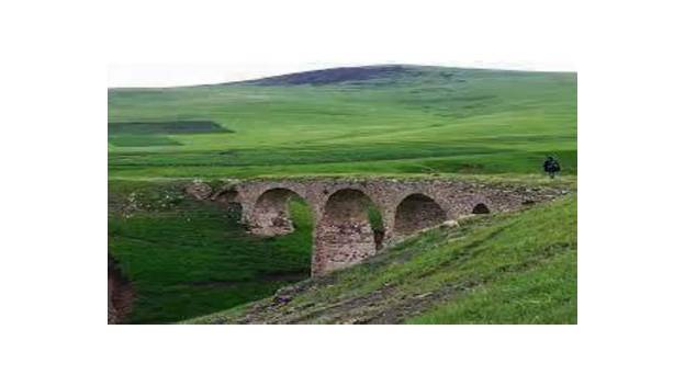
Gadabay’s landscape is mountain forest, mountain meadow and alpine ground, with broad-leaved forests in the midlands and subalpine and alpine meadows at the tops of the mountains (AzerNews). Goshabulag, at 3,549 metres, is the district’s highest peak named in the AzerNews account, and July temperatures range from +10 °C to +20 °C while January temperatures range from −2 °C to −10 °C (AzerNews). Mineral springs near Slavyanka village include Narzan, Mor-Mor and Chaldash, and the Shamkir River offers conditions for fishing (AzerNews). The district’s monuments include Cyclopean structures from the end of the Bronze Age, the Boyuk-gala fortress, the towers of Galakend-galasi from the sixteenth century, Giz-galasi from the ninth century, a nineteenth-century arched bridge, and Koroglu Castle, an eighteenth-century showplace whose walls are one metre thick (AzerNews). Beyukgala fortress at Soyudlu village belongs to the Iron Age and is listed among monuments of world importance (AzerNews).
The district today
As an administrative unit, Gadabay originated on 8 August 1930 under the name of Rustam Aliyev and was renamed Gadabay in 1938 (AzerNews). The district’s population fell from 78,100 in 1979 to 75,700 in 1989, then rose to 95,756 at the 2019 census, with a 2025 estimate of 101,400; in 2019 there were 47,913 males and 47,843 females, with 85,519 rural residents and 10,237 urban residents (CityPopulation). Modern mining continues on the same hill as the old Gedabey mine: Anglo Asian Mining’s Gedabek operation reported full-year 2024 production of 16,760 gold equivalent ounces, down from 31,821 in 2023, after full processing restarted (Anglo Asian Mining). The Siemens heritage survives: more than twenty railway arches remain on the Gedabey–Galakent route, the Culture House still serves as the town’s only library, and the old mine hill is still called Copper Hill, Mis Dağı (Visions of Azerbaijan; Visions of Azerbaijan).
| Census or estimate | District population | Change |
|---|---|---|
| 1979 census | 78,100 | — |
| 1989 census | 75,700 | −2,400 |
| 2019 census | 95,756 | +20,056 |
| 2025 estimate | 101,400 | +5,644 |
Source: CityPopulation, sourcing the State Statistical Committee of the Republic of Azerbaijan.
Frequently asked questions
Where is Gedabey? Gedabey is a mountain town in western Azerbaijan, the capital of Gadabay District in the Lesser Caucasus, about 400 kilometres from Baku. The district covers the northern parts of Shahdagh Mount, part of the Bashkend-Dastafur depression and the Shamkir massif, with the Akhinja, Zayam and Shamkir as its largest rivers.
What did the Siemens brothers do in Gedabey? The Siemens brothers — Werner, Carl, Walter and Otto — bought the Gedabey copper mine in 1865 and ran it privately until Soviet nationalisation in 1920. They built smelters, the Gedabey–Galakent railway, a hydroelectric plant and a petroleum pipeline, and produced 58,000 tonnes of copper between 1867 and 1914.
Is mining still active at Gedabek? Yes. Anglo Asian Mining’s Gedabek operation reported full-year 2024 production of 16,760 gold equivalent ounces after full processing restarted, with agitation leaching and flotation at design capacity. Development of the new Gilar underground mine was progressing, with first development ore expected in early 2025.
What is there to see in Gadabay District? The district offers mountain forests, mineral springs at Narzan, Mor-Mor and Chaldash, and monuments including Koroglu Castle, Beyukgala fortress at Soyudlu, the Galakend-galasi towers, Giz-galasi and a nineteenth-century arched bridge. More than twenty arches survive from the Siemens-era Gedabey–Galakent railway route.
What this profile does not claim
- It does not settle the origin of the name Gedabey; three versions are recorded and none is chosen.
- It does not give an exact length for the Gedabey–Galakent railway, since sources disagree between 28 km, over 30 km and “some twenty miles”.
- It does not give a town-only population for Gedabey; the figures quoted are district figures.
- It does not detail uranium mining; uranium is listed among the district’s resources but no production evidence was found in the sources read.
- It does not assert that the Siemens-era buildings survive unchanged; most have been privatised or repurposed, and the profile reports their present uses where the sources state them.
Timeline
- XIV–VII centuries BC
- The Khojaly–Gadabay culture of the Late Bronze Age and Early Iron Age is identified from archaeological finds in Gadabay and Khojaly.
- 1849
- Copper ore is discovered in Gadabay.
- 1855–1856
- A copper smelter is built on the basis of the newly discovered ore.
- 1863
- The city of Gadabay is founded, in tsarist Russia's Elizavetpol district.
- 1865
- The Siemens brothers complete their purchase of the Gedabey copper mine.
- 1879–1883
- The Siemens brothers complete the Gedabey–Galakent narrow-gauge railway.
- 1883
- A new copper smelter is built at Qalakend (Galakent), with a hydroelectric plant.
- 1892
- A petroleum pipeline from Dallar station near Shamkir reaches the smelters, later extended to Gedabey.
- 1920
- Soviet nationalisation ends the Siemens brothers' era in Gedabey.
- 1930
- Gadabay originates as an administrative unit on 8 August 1930 under the name of Rustam Aliyev; it is renamed Gadabay in 1938.
- 2024
- Anglo Asian Mining reports full-year production of 16,760 gold equivalent ounces after full processing resumes at Gedabek.
What we could not verify
These claims came up in research and could not be confirmed. They are recorded here rather than published as fact or quietly dropped. If you hold a source that settles one, please tell us.
- Peak heights conflict across summaries: the AzerNews account lists Goshabulag at 3,549 m and also gives a second 3,549 m figure and Godzhadagh at 2,217 m, while other summaries give Gojadag at 3,317 m. The profile uses only the Goshabulag figure.
- The Gedabey–Galakent railway's exact length is disputed — 28 km, over 30 km, or Werner von Siemens's 'some twenty miles' (about 32 km) — so the profile gives no exact length.
- The name's origin is unresolved: the academic source records three versions — Turkic get/gedik (hill) plus bek (guard), a man named Gədəbəy, and a phonetic shift from Dədəbəy — without choosing between them.
- Only district population figures are given; a town-only population for Gedabey itself was not verified in a citable source read in full.
- AzerNews lists uranium among the district's underground resources, but no source read in full evidenced uranium production, so the profile does not detail it.
Sources
6 sources (1 tier 1, 3 tier 2, 1 tier 3, 1 first-party), each opened and read against the claim it supports. Statements the subject makes about itself are marked as such and are not treated as independent evidence. See the source policy.
- Supports: Khojaly–Gadabay culture (XIV–VII centuries BC); city founded 1863; copper ore 1849; smelter 1855–1856; Siemens transfer; Galakand hydroelectric plant first in tsarist Russia; 109 settlements, 20 municipalities, about 400 km from Baku; three name-origin versions Open original source
- Supports: Siemens purchase 1865; smelter 1865; 6-km railway 1873; Qalakend smelter 1883; Gedabey–Qalakend railway 1879–83; petroleum pipeline 1892; hydroelectric plant first in imperial Russia; 58,000 t copper, over 3 t gold, 12 t silver 1867–1914; 20% of Russian Empire copper; nationalisation 1920; town buildings, hospital, schools, surviving heritage Open original source
- Supports: Siemens operations 1865–1920 on Mis Dağı; Galakent second smelting plant; railway 1879–1883; route villages Miskinli, Chaldash, Duzyurd, Sabatkechmaz, Chalburun; 23 surviving arch-bridges; Bloody Bridge crash story; length dispute Open original source
- Supports: Lesser Caucasus setting; rivers Akhinja, Zayam, Shamkir; forests Govdu, Godekdere, Gamish, Shamlig; Goshabulag 3,549 m; July +10 to +20 C, January −2 to −10 C; Koroglu Castle, Beyukgala, Galakend-galasi, Giz-galasi; gold, uranium, copper; district originated 8 August 1930 as Rustam Aliyev, renamed 1938 Open original source
- Supports: District population 78,100 (1979), 75,700 (1989), 95,756 (2019), 101,400 (2025 estimate); 2019 gender split 47,913 male, 47,843 female; rural 85,519, urban 10,237 Open original source
- Q4 and FY 2024 Production and Operations Review First-partySupports: FY 2024 production 16,760 gold equivalent ounces (FY 2023: 31,821); full production restarted at Gedabek with agitation leaching and flotation at design capacity; Gilar underground mine development Open original source
Support independent research
Found this profile useful?
You can support FactsLedger by making a donation. Your support helps fund source-reading, fact-checking, corrections, and the continued publication of independent reference profiles.
Support the research